Latest Developments in GNSS-IR
Exploring recent advances in GNSS Interferometric Reflectometry...
Read MoreResearch Assistant & GNSS-IR Specialist
Department of Geomatic Engineering
Yildiz Technical University
Specializing in GNSS Interferometric Reflectometry (GNSS-IR) and environmental monitoring, with a focus on developing innovative solutions for sea level studies and snow depth measurements.

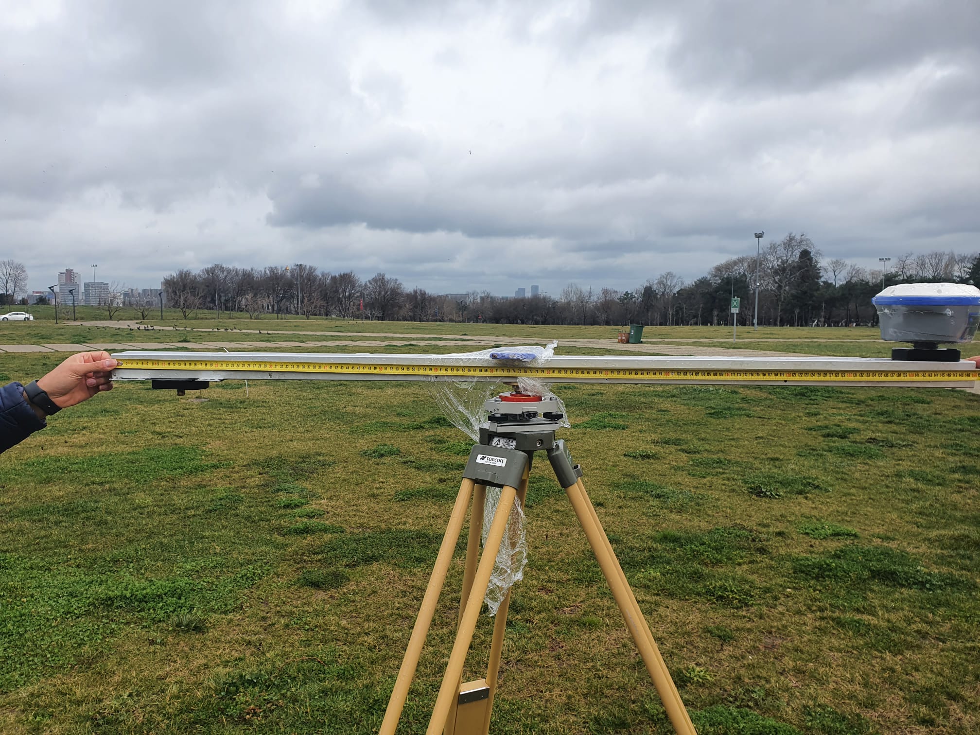
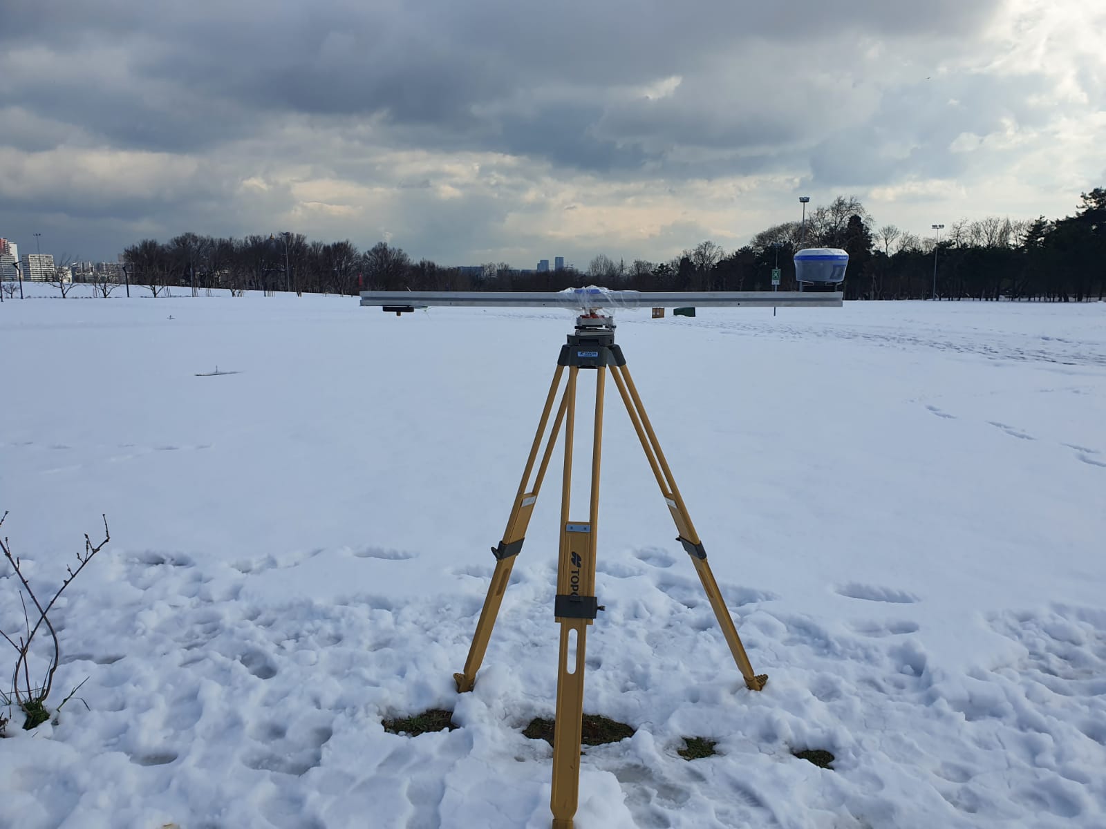
I am a researcher specializing in GNSS Interferometric Reflectometry (GNSS-IR) and sea level studies. Since 2018, I have been serving as a Research Assistant in the Department of Geomatic Engineering at Yildiz Technical University. Currently, I am a visiting researcher at the National Oceanography Centre Liverpool, UK, where I focus on improving GNSS-IR sea level retrievals. My expertise includes developing software tools in MATLAB and Python for data analysis, and I integrate AI models in my research to enhance GNSS-IR techniques and their applications in environmental monitoring.
Specializing in GNSS-IR techniques for environmental monitoring and sea level measurements, with a focus on improving retrieval methods.
Development of specialized tools and algorithms for GNSS data processing using MATLAB and Python, focusing on efficiency and automation.
Research on Precise Point Positioning techniques, focusing on accuracy improvements and real-time applications.
Integration of machine learning and AI techniques in GNSS data processing and environmental monitoring applications.
A platform dedicated to creating simple and practical web applications tailored for individuals working with GNSS data. Built with HTML, CSS, and JavaScript, our tools are designed to be lightweight, user-friendly, and accessible to everyone.
A user-friendly calendar tool that provides detailed GNSS time information, including Julian Day Numbers, GPS Week Numbers, and more, for any selected date.
An interactive web-based visualization tool for tracking GNSS satellites in real-time, displaying positions of GPS, GLONASS, Galileo, and BeiDou satellites on a world map.
Loading publications...
Loading publications...
Loading publications...
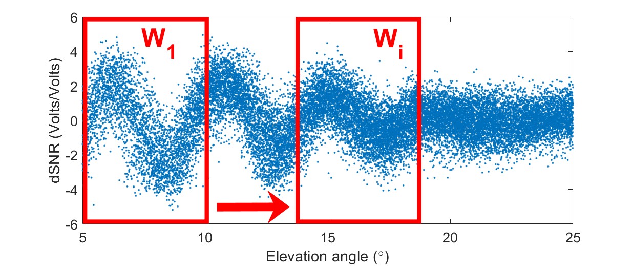
GIRAS (GNSS-IR Analysis Software) is an open-source MATLAB-based software for GNSS-IR analysis. It can process multi-constellation GNSS signal data and estimate the SNR metrics for applications such as snow depth retrieval, effective reflector height estimation, and soil moisture monitoring.
Exploring recent advances in GNSS Interferometric Reflectometry...
Read MoreAcademic Email: cemali@yildiz.edu.tr
Personal Email: cemalialtuntas@gmail.com
Permanent Address:
Department of Geomatic Engineering
Yildiz Technical University
Istanbul, Turkey
Visiting Address (Feb 2025 - Nov 2025):
National Oceanography Centre
Liverpool, UK